
Walk a Radcliff Street Record
A useful Radcliff street directory search separates ownership from occupancy. The Hardin Property Valuation Administrator, or PVA, ties a situs address to an owner and parcel. The county GIS places that parcel beside the lots around it. The Clerk then uses the owner's name, not the address, to retrieve deeds and related instruments. Voter material is more restricted and should never be treated as a public household list.
- Enter the full address in the Hardin PVA property search. Save the owner name, parcel or map ID, situs address, mailing address, and deed book and page if shown.
- Open the county GIS viewer and locate the same parcel. Check adjacent parcels, road spelling, subdivision lines, and map context, but treat the viewer as informational.
- Compare the address with the public precinct map. A precinct label can help orient a Radcliff street, though it does not prove ownership or residence.
- Take the owner name and date range to the Hardin County Clerk name index. Search grantor and grantee roles, then preserve every book and page reference.
- For an older trail, test historical place names, plats, maps, and any directory volume whose coverage has been confirmed by its custodian.
The flow is address to parcel, parcel to owner, owner to deed, then deed to an earlier owner. That order matters because the Clerk's own instructions say the land-record portal does not index by address. It also prevents a mailing address from being mistaken for the physical parcel.
Radcliff Street Search at PVA
The Hardin PVA record page describes current and prior owner searches along with location, land use, value, tax, sale, map, zoning, and structure details. The county-linked qPublic screen is the logical first stop for an address. Its dynamic controls were not exposed in the research capture, so exact current labels should be read on the live form rather than guessed.
| Parcel-card field | Street-search value | Caution |
|---|---|---|
| Situs or location address | Identifies the physical Radcliff parcel | May differ from owner mail |
| Owner and care-of line | Provides the deed-index search name | Does not list a full household |
| Parcel number or map ID | Connects the card to GIS and tax records | Copy every character |
| Deed book, page, and date | Points toward the recorded instrument | Verify in the Clerk index |
| Subdivision, lot, acreage | Helps match plats and old descriptions | Not a USPS address by itself |
The captured Hardin qPublic entry screen shows why visual confirmation is useful before relying on a portal control.
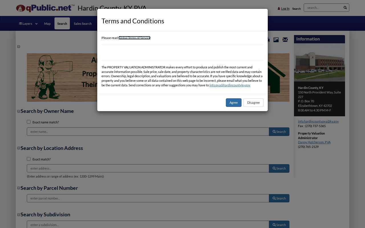
A parcel result is strong owner evidence as of its assessment date, but it cannot establish every person who lives at the address.
Radcliff Records Keyed by Address
No single office keeps a complete street directory for Radcliff. Each record set answers a narrower question, and several access routes require a direct request when the online tool does not provide the needed field.
| Address source | Custodian | What it can show | Access path |
|---|---|---|---|
| Property roll | Hardin PVA | Owner, parcel, mailing, sale, value, structure | County page, qPublic, phone |
| Parcel map | Hardin County GIS | Lot position, nearby parcels, map context | Public ArcGIS viewer |
| Recorded land papers | Hardin County Clerk | Deeds, liens, mortgages, releases, plats | Name index, archive, office request |
| Planning records | Radcliff Planning and Building | Zoning, subdivision, annexation, permits | Department contact; no public case index confirmed |
| Precinct geography | Hardin County elections | Election-area context for a street | Public precinct maps; bulk voter data restricted |
The parcel number is the best common key for property systems. A street name helps with PVA and map work, while the deed index changes the search to a person's name. For records not online, Kentucky's Open Records Act route can be used with a narrow description of the address, date span, department, and record type.
Turn Radcliff Addresses Into Deeds
The Hardin Clerk indexed-record search asks for Last or Firm Name, First Name, Middle, Title, Party, date range, Index Type, Groups, and Kind. Guest access is offered. Because there is no address index, first collect the owner from PVA, then search that person as a grantee to find an acquisition and as a grantor to find a later transfer.
The search result can expose grantor, grantee, document type, recording date, book, page, and legal-description text. Keep road names, acreage, subdivision, lot, map ID, and book/page exactly as printed. A bank may appear because a mortgage or release is part of the chain, not because it occupied the property.
The manifest image captures the live name-search controls for the by-address handoff.
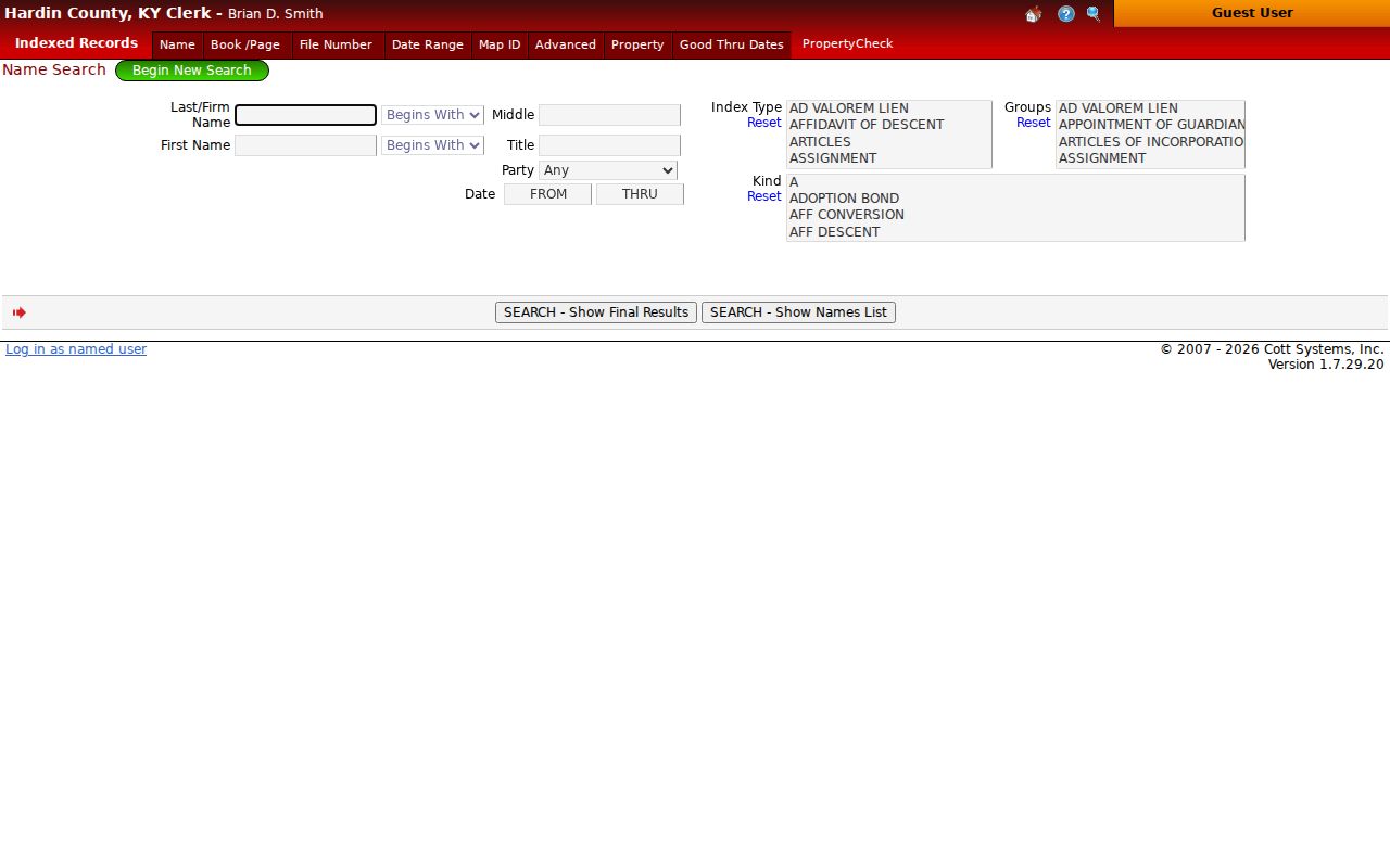
The screen makes the key limitation plain: a Radcliff street address must be converted to an owner name before the current deed search becomes useful.
For older books, use the Clerk archive, which describes deed books A through Z and 1 through 99 from 1793 through 1938. Index-book, first-letter, book/page, old plat, and restriction paths fill the gap when the modern index stops short. Large files may need to be saved, and a certified copy still comes from the custodian.
Note: The Radcliff branch handles vehicle registration and marriage-license matters, but land recordings must go to the Elizabethtown recording office.
Radcliff Street Record Terms
Property language is compact. Defining it before copying a result prevents the wrong number or address from entering the street-by-street trail.
- Parcel
- A mapped unit of land identified by the PVA or GIS with a parcel number or map ID.
- Situs address
- The physical location of the property, which can differ from the owner's mailing address.
- Plat
- A recorded map of lots, boundaries, roads, or a subdivision. It helps connect legal descriptions to today's map.
- Criss-cross directory
- A directory arranged by street or address rather than surname. No confirmed Radcliff title or year run was found.
Assessment flags also need care. A homestead classification is used for tax assessment. It is not proof of every household member or of current occupancy.
Map Radcliff Streets in GIS
The Hardin County GIS page leads to a public ArcGIS map for parcel context. Use the map to inspect parcels along the same road, compare nearby lot lines, and match a map ID from PVA. Exact layer and control names were not available in the text capture, so the live viewer is the authority for its current interface.
County warnings matter. The viewer is for informational and viewing use, boundaries may appear skewed because coordinate systems differ, and the map is not designed as a survey or development instrument. A GIS line is a lead to a recorded plat or deed, not final boundary evidence.
Radcliff's precinct names add another geography layer: East, North, Northwest, West, Southwest, South, and Southeast sit near Fort Knox 26 and 27, Veterans, Parkway, Woodland, City Park, and Lincoln Trail areas. That context can help place an uncertain street, but precinct borders do not show who owns or occupies a parcel.
Radcliff Planning Records by Street
The Radcliff Planning and Building office handles zoning, subdivision rules, site plans, annexation, floodplain work, and building permits. Those terms are helpful when a deed names a subdivision and lot while a newer record uses a numbered street. The office publishes a contact route and phone, but no official searchable permit or code-case database was located.
Ask for a precise record instead of a broad sweep. Give the street address, parcel number if known, record class, and a reasonable date range. A permit may identify a project or owner connected to the work, yet it should not be stretched into proof of a whole household. The same limit applies to code-board and finance records.
Monitor Radcliff Property Records
The Hardin County Clerk offers a separate property-record monitoring route called PropertyCheck or Recordhub. It is not the same tool as the PVA parcel search, and it is not a resident list. The service is meant to alert an enrolled user when a new instrument associated with selected property information enters the recording system. The Clerk's current notice describes it as free and directs users through the research page.
Visit the Hardin Clerk research page, choose Property Check, and follow the account instructions shown there. A 2026 update tells existing users to use the password-reset path, accept the current terms, and avoid entering payment details because the service is free. Exact alert fields and delivery timing were not exposed in the research capture, so read the live enrollment terms before choosing a name or parcel.
Monitoring does not replace a title search or prove who lives on a Radcliff street. It can flag a new recording for review, after which the document type, parties, date, legal description, and book/page should be checked in the official index. If a notice looks unfamiliar, contact the Clerk through its published office channels and preserve the alert without sharing account credentials.
Older Names Behind Radcliff Streets
A failed modern-address search may be a geography problem. Radcliff's official history traces the area through Mill Creek, the 1919 naming for Major William Radcliffe, New Stithton's absorption by Fort Knox in 1932, and city incorporation in 1956. Older deeds and catalogs may therefore use Mill Creek, New Stithton, Camp Knox, Fort Knox, Dixie, Lincoln Trail, a subdivision, or a road description.
No verified citywide street-renumbering table or renaming year was found. Do not invent a direct old-to-new match. Compare legal descriptions, county plats, the city timeline, and the Hardin County History Museum's vintage maps, which include listed map years from 1797 through the twentieth century. The Radcliff directory book research explains why the confirmed historical shelf must also be checked for true locality coverage.
Note: Preserve both City Hall ZIP forms during address research because its street mail uses 40160 while its published post-office box uses 40159.
Limits of Radcliff Street Directories
A deed identifies parties to a recorded transaction. A parcel card generally identifies an assessed owner and mailing contact. Neither source proves every adult, child, relative, guest, or other person present at a Radcliff address. The voter status tool is designed for a voter checking personal registration and polling details, not for browsing a whole street. Bulk voter data has requester and purpose restrictions under Kentucky law.
Utilities, driver records, protected addresses, and many personal details are not open street-directory fields. Dates also drift: a sale may be recorded after a move, a mailing address may belong to an agent, and a parcel card may trail a recent deed. Verify a material result with the custodian and retain the record date.
Use a simple source log for close calls. Write down the portal or office, search terms, result date, parcel number, book and page, and the exact reason two records appear to match. Keep a separate note for similar names that do not match. Radcliff's military-adjacent population and movement make surname-only conclusions weak, so middle names, prior names, dates, subdivisions, precincts, and legal descriptions are better controls. When sources disagree, the dated original record and its custodian should carry more weight than a copied index entry.
Lawful use. Use Radcliff address records only for lawful personal research, property questions, genealogy, or civic understanding. Never use them to stalk, threaten, harass, or harm anyone.