
Radcliff Neighbor Records Compared
The immediate block has several public layers, and each answers a different question. HCGO GIS supplies mapped geometry. The PVA property card may supply owner, mailing, situs, parcel, sales, and assessment fields. Clerk records explain recorded transfers by name. City and election sources show zones, precincts, boards, and public meetings. None establishes every person who lives behind a door.
| Source | What it shows about a block | Access |
|---|---|---|
| HCGO GIS | Parcel shapes, roads, map context, possible IDs | Public dynamic viewer |
| qPublic/PVA | Owner, mailing and situs, sales, parcel facts | County-linked search |
| Clerk eSearch | Transfers and instruments by party, date, type | Public name index, no address index |
| City Planning | Zoning, subdivision, floodplain, permit request route | Phone or records request |
| Precinct maps | Named election areas around Radcliff and Fort Knox | County Clerk map page |
| SBE-84 voter data | Approved fields and ordering for qualified requesters | Purpose-limited request |
Use a date stamp for each lookup. Parcel cards change after transfers, precincts can change, and map layers may be updated on a different schedule than deeds.
Map Nearby Radcliff Parcels
Start with the Hardin County GIS Online map. The county supports public map viewing and searching, but its dynamic viewer did not expose a stable text list of controls. Do not assume that a buffer, radius, or bulk selection tool exists. Basic address locating, map browsing, and individual parcel checks form the verified route.
- Find the target address in qPublic or HCGO and record its parcel ID and legal description.
- Click or identify the target polygon, then pan and zoom to each adjoining shape.
- Record a nearby parcel ID or situs only when the popup actually displays it.
- If no owner appears, carry the parcel ID into PVA and search that parcel alone.
- Keep roads, common land, utility corridors, rear lots, and Fort Knox land out of a household list.
The county warns that GIS data are informational and that boundaries can be skewed by coordinate-system differences. A mapped edge does not prove a shared fence, ownership, occupancy, or social relationship. For a whole named road rather than one block, use the Radcliff Street Directory.
Confirm Radcliff Owners in PVA
The county's PVA description says property searches may show current and previous owners, parcel or map ID, situs and mailing addresses, sales history, assessed value, exemptions, and building facts. Exact live labels were not fully rendered during research, so read what the current result says rather than borrowing controls from another county.
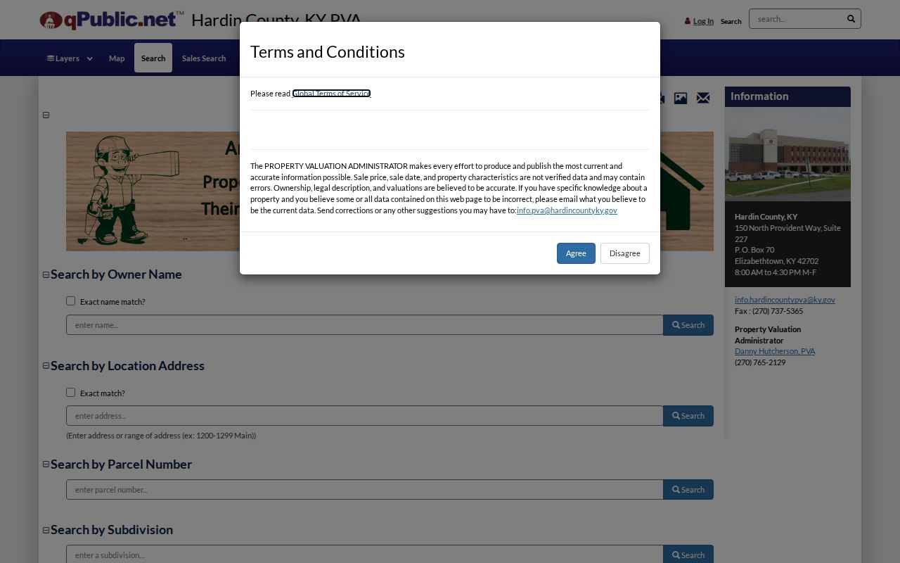
The Hardin PVA/qPublic search entry appears below.
- Situs address
- The physical location label attached to a parcel.
- Mailing address
- The place where assessment notices go, which may be elsewhere.
- Parcel
- A mapped unit of land with its own identifying number.
- Legal description
- The recorded lot, subdivision, acreage, or boundary wording.
A homestead or other exemption can help assess a record, but it is not a complete household list. The same is true of a previous-owner field. Compare dates before drawing any conclusion about your Radcliff neighbors.
Radcliff Precincts Frame the Block
Hardin County Clerk precinct maps label Radcliff East, North, Northwest, West, Southwest, South, and Southeast, with Fort Knox precincts 26 and 27 nearby. These names are a useful geography layer. They can help place a block within election administration, but they do not disclose who lives at each address.
The normal Kentucky Voter Information Center is person based. It requires legal first name, last name, and date of birth, with optional last-four SSN shown. It is not a street browser. A full file in street or ZIP order follows the SBE-84 request, qualifying-purpose rules, oath, delivery choices, and 31 KAR 3:010. The form says to allow 7 to 10 business days.
Protected fields. Full dates of birth, Social Security numbers, ID numbers, and ballot choices do not belong in a Radcliff block profile.
Safe at Home participants use a substitute address and voter protections. A missing or substituted address is not proof that a person has left the block. Public residency reports give aggregate maintenance context and are not a substitute for approved data access.
Radcliff Civic Groups, Not Rosters
No official current umbrella directory for Radcliff neighborhood associations or HOAs was found. That gap should remain visible. City boards and recreation groups offer legitimate public contacts, but their member or program pages are not directories of nearby households.
| Community layer | Public role | Directory limit |
|---|---|---|
| Planning Commission | Zoning, subdivision, plans, first-Thursday meetings | Board names, no household roll |
| Board of Adjustment | Variances and conditional uses | Public board information only |
| Code Enforcement Board | Civil ordinance matters, second-Tuesday meetings | No public case-name index found |
| Forestry and Conservation Board | Saunders Springs and natural environment | No member-address directory |
| Parks associations | Youth sport and program contacts | Registration data is not a resident roll |
| ATHS and genealogy society | Historical research and cemetery sources | Not a current neighbor roster |
City Planning and Building can address zoning, annexation, floodplain, subdivision, permit, and code questions at 270-351-1875. No public online permit or case index was located. A focused request should state the address, parcel if known, record type, approximate year, and desired format.
Official Radcliff Sources Work Differently
Commercial neighbor tools often merge old public fragments and inferred relationships into a single profile. That can look convenient, but it hides the custodian, record date, and difference between an owner and an occupant. Official sources take more steps because they preserve those distinctions.
| Official records | Commercial category |
|---|---|
| Names a custodian and source date | May merge sources without clear dates |
| Separates parcel, deed, precinct, and city files | May infer a household or relationship |
| Offers counter, phone, mail, and request routes | Correction and removal routes vary |
| Supports checking the original record | Profile text is not an official record |
When the map fails, call Hardin GIS at 270-360-9207 during its published weekday hours. When the PVA result is unclear, ask that office about the parcel card. For deeds, use the owner name in Clerk eSearch or ask the recording office for a book/page. For city records, contact the city custodian under the Kentucky Open Records Act. These fallbacks are part of the search, not an afterthought.
Fort Knox Shapes Radcliff Blocks
Radcliff grew beside Fort Knox, and the map can place military land, a public road, a rear parcel, or a common tract next to a neighborhood lot. The city's older names add more context: Mill Creek appears in early history, Radcliff was named after a 1919 subdivision, and New Stithton was absorbed into Fort Knox in 1932. A modern block should not be projected unchanged onto those earlier years.
Use current parcel geometry for the present block and historic maps only for time context. The Hardin County History Museum lists county and area maps from 1797, 1816, 1847, 1868, 1871, 1891, 1922, and 1935. Those maps may help explain roads and labels, but the museum does not advertise a resident index.
For community research, Ancestral Trails Historical Society began in Radcliff in 1975 and works across a ten-county region on genealogy, cemeteries, historic buildings, and public records. It can point toward history sources. It cannot confirm who lives beside a current address.
Protect Radcliff Neighbor Privacy
A GIS polygon shows land, not every person present. A deed or PVA card identifies a recorded interest, not renters, relatives, guests, or service users. Utility, delivery, DMV, and private association lists were not found as public Radcliff datasets. Federal driver-record law and Kentucky address-confidentiality rules also keep sensitive locations outside an ordinary block lookup.
For a careful block review, check only the parcels needed for a clear personal task. Keep citations and dates. Do not publish a bulk list, infer a relationship from proximity, or treat a party or voter status as proof that someone shares a home.
When a public record seems wrong, take the correction to its custodian. The PVA can explain an assessment card, the Clerk can locate a recorded instrument, city staff can route a planning or code-record request, and election officials control voter data. A commercial profile cannot correct any of those official files. Save the parcel, book and page, case number, or request date so the office can identify the exact item.
Some gaps are deliberate. Kentucky Safe at Home can substitute a protected address for qualifying participants, and voter disclosure has purpose limits. Sealed, juvenile, or expunged court information may also be absent. Respect those limits. Looking at adjoining public parcels does not create a right to private contact details, private group membership, or facts about children and other household members.
Lawful use. Learn about Radcliff neighbors for civic curiosity, reconnection, or personal safety, never to watch, intimidate, harass, or harm anyone.